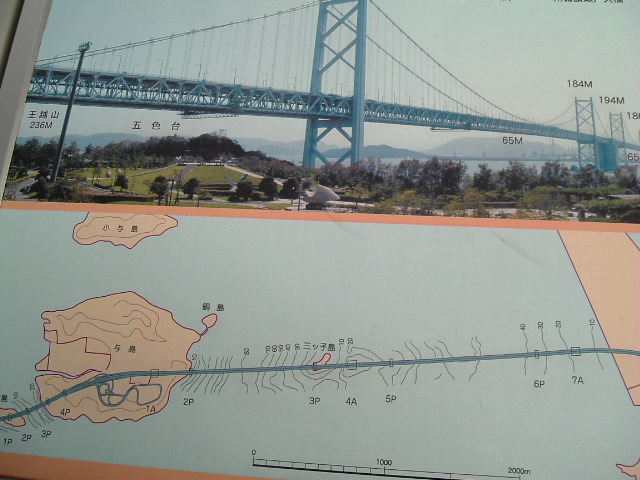
 The map illustration of the Seto Ohashi bridge over the inland sea in front of the bridge itself...
 Notice the railway train running in the middle rung of the Seto Ohashi Bridge...


Notice the splendid design work and structural efficiency in the planning of the Seto Ohashi Bridge... The grid design supports a 2-way railway line and the 2-way expressway by lodging itself securely on an island in the inland sea


An illustrative map of the Seto Ohashi Bridge area across the Inland Sea

The 2-way road expressway has a 2-way railway line running below it above the Inland Sea.


 The first sighting of the Seto Ohashi Bridge... after you come out of the tunnel on the expressway. The World's largest bridge system spans the Seto Inland Sea National Park near Washuzan, linking Honshu and Shikoku.
More than 12.3 km long, the magnificent Seto Ohashi is aesthetically designed to harmonize with the natural beauty of the forested islands and the surrounding sea.
There is also a high-speed cruise available leaving regularly from the Kojima Sightseeing Pier east of JR Kojima Station.

Arriving at our first sighting of the Seto Ohashi Bridge, in Kojima district, Okayama, Japan. We are driving through a tunnel on the expressway. Notice the GPS terminal on the dashboard... showing the location of the vehicle on the road network in Japan... all the time... all the time... all the time...

No comments:
Post a Comment